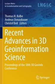
Recent Advances in 3D Geoinformation Science
Proceedings of the 18th 3D GeoInfo Conference
Sorozatcím: Lecture Notes in Geoinformation and Cartography;
-
20% KEDVEZMÉNY?
- A kedvezmény csak az 'Értesítés a kedvenc témákról' hírlevelünk címzettjeinek rendeléseire érvényes.
- Kiadói listaár EUR 267.49
-
110 941 Ft (105 658 Ft + 5% áfa)
Az ár azért becsült, mert a rendelés pillanatában nem lehet pontosan tudni, hogy a beérkezéskor milyen lesz a forint árfolyama az adott termék eredeti devizájához képest. Ha a forint romlana, kissé többet, ha javulna, kissé kevesebbet kell majd fizetnie.
- Kedvezmény(ek) 20% (cc. 22 188 Ft off)
- Kedvezményes ár 88 753 Ft (84 526 Ft + 5% áfa)
Iratkozzon fel most és részesüljön kedvezőbb árainkból!
Feliratkozom
110 941 Ft

Beszerezhetőség
Megrendelésre a kiadó utánnyomja a könyvet. Rendelhető, de a szokásosnál kicsit lassabban érkezik meg.
Why don't you give exact delivery time?
A beszerzés időigényét az eddigi tapasztalatokra alapozva adjuk meg. Azért becsült, mert a terméket külföldről hozzuk be, így a kiadó kiszolgálásának pillanatnyi gyorsaságától is függ. A megadottnál gyorsabb és lassabb szállítás is elképzelhető, de mindent megteszünk, hogy Ön a lehető leghamarabb jusson hozzá a termékhez.
A termék adatai:
- Kiadó Springer Nature Switzerland
- Megjelenés dátuma 2025. február 22.
- Kötetek száma 1 pieces, Book
- ISBN 9783031437014
- Kötéstípus Puhakötés
- Lásd még 9783031436987
- Terjedelem861 oldal
- Méret 235x155 mm
- Nyelv angol
- Illusztrációk XIII, 861 p. 463 illus., 443 illus. in color. Illustrations, black & white 639
Kategóriák
Hosszú leírás:
The book includes the contributions to the international conference “18th 3D GeoInfo”. The papers published in the book were selected through a double-blind review process. 3D GeoInfo has been the forum joining researchers, professionals, software developers, and data providers designing and developing innovative concepts, tools, and application related to 3D geo data processing, modeling, management, analytics, and simulation. A big focus is on topics related to data modeling for 3D city and landscape models as well as their many and diverse applications. This conference series is very successfully running since 2006 and has been hosted by countries in Europe, Asia, Africa, North America, and Australia. In the period 2006 to 2017, the proceedings has been published by Springer in this series with Thomas H. Kolbe being the editor of the 2010 edition of the conference proceedings.
18th 3DGeoInfo was organized by Technical University of Munich in cooperation with the German Society for Photogrammetry, Remote Sensing and Geoinformation (DGPF), the local associations Runder Tisch GIS e.V. (Round Table GIS) and Leonhard Obermeyer Center—TUM Center of Digital Methods for the Built Environment, and the City of Munich. The international program committee consisted of committee members of previous 3D GeoInfo conferences and further leading scientists in the field of 3D Geoinformation Science.
Tartalomjegyzék:
Applications of 3D City Models and Digital Twins.- Virtual and Augmented Reality and Visualization.- GIS / BIM Integration.- 3D Point Cloud Processing and Analysis.- Deriving 3D Models from Point Clouds.- 3D Data Acquisition, Analysis and Simulation for Urban Digital Twins.- 3D Data Modelling and Topology.- Indoor / Outdoor Modelling and Navigation.- Sensors and Dynamic Data in Urban Digital Twins.- Software and Tools for Spatial Data.- An Overview of the 3DGeoInfo Conference Series.
Több


