

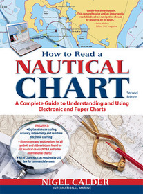
How to Read a Nautical Chart, 2nd Edition (Includes ALL of Chart #1)
A Complete Guide to Using and Understanding Electronic and Paper Charts
Sorozatcím: INTERNATIONAL MARINE-RMP;
-
10% KEDVEZMÉNY?
- A kedvezmény csak az 'Értesítés a kedvenc témákról' hírlevelünk címzettjeinek rendeléseire érvényes.
- Kiadói listaár GBP 19.00
-
8 578 Ft (8 170 Ft + 5% áfa)
Az ár azért becsült, mert a rendelés pillanatában nem lehet pontosan tudni, hogy a beérkezéskor milyen lesz a forint árfolyama az adott termék eredeti devizájához képest. Ha a forint romlana, kissé többet, ha javulna, kissé kevesebbet kell majd fizetnie.
- Kedvezmény(ek) 10% (kb. 857 Ft)
- Kedvezményes ár 7 721 Ft (7 353 Ft + 5% áfa)
Iratkozzon fel most és részesüljön kedvezőbb árainkból!
Feliratkozom
8 578 Ft

Beszerezhetőség
Becsült beszerzési idő: A Prosperónál jelenleg nincsen raktáron, de a kiadónál igen. Beszerzés kb. 3-5 hét..
A Prosperónál jelenleg nincsen raktáron.
Why don't you give exact delivery time?
A beszerzés időigényét az eddigi tapasztalatokra alapozva adjuk meg. Azért becsült, mert a terméket külföldről hozzuk be, így a kiadó kiszolgálásának pillanatnyi gyorsaságától is függ. A megadottnál gyorsabb és lassabb szállítás is elképzelhető, de mindent megteszünk, hogy Ön a lehető leghamarabb jusson hozzá a termékhez.
A termék adatai:
- Kiadás sorszáma 2
- Kiadó International Marine
- Megjelenés dátuma 2012. június 16.
- ISBN 9780071779821
- Kötéstípus Puhakötés
- Terjedelem272 oldal
- Méret 274x215x15 mm
- Súly 553 g
- Nyelv angol 0
Kategóriák
Hosszú leírás:
Authoritative, practical, and hands-on information on reading and relying on electronic and paper nautical charts
The classic How to Read a Nautical Chart explains every aspect of electronic and paper nautical charts: how a chart is assembled, how to gauge the accuracy of chart data, how to read charts created by other governments, how to use information such as scale, projection technique and datum that every chart contains; how not to get fooled or run aground by overzooming. Nigel Calder teaches you how to squeeze every ounce of information out of a nautical chart (on your GPS, chartplotter, or nav station) and understand the limits of accuracy for all charts, paper and electronic, raster and vector.
This much-awaited second edition addresses the changes in the world of electronic charting, integrated onboard navigation systems, as well as radar overlays and AIS and their interfacing with charts. A new chapter onthe Wiki Revolution explores the mechanisms allowing you to incorporate user-generated content into navigational products and share this content with others—harnessing a user-base never before possible. Calder also explores how 3D-technology and real-time depth and weather information is creating interactive charting capacities that are fundamentally changing how we navigate. Calder's unique, practical insights will help you to navigate safely for years to come.Authoritative, practical, and hands-on information on reading and relying on electronic and paper nautical charts
The classic How to Read a Nautical Chart explains every aspect of electronic and paper nautical charts: how a chart is assembled, how to gauge the accuracy of chart data, how to read charts created by other governments, how to use information such as scale, projection technique and datum that every chart contains; how not to get fooled or run aground by overzooming. Nigel Calder teaches you how to squeeze every ounce of information out of a nautical chart (on your GPS, chartplotter, or nav station) and understand the limits of accuracy for all charts, paper and electronic, raster and vector.
This much-awaited second edition addresses the changes in the world of electronic charting, integrated onboard navigation systems, as well as radar overlays and AIS and their interfacing with charts. A new chapter onthe Wiki Revolution explores the mechanisms allowing you to incorporate user-generated content into navigational products and share this content with others—harnessing a user-base never before possible. Calder also explores how 3D-technology and real-time depth and weather information is creating interactive charting capacities that are fundamentally changing how we navigate. Calder's unique, practical insights will help you to navigate safely for years to come. Több
