

-
10% KEDVEZMÉNY?
- A kedvezmény csak az 'Értesítés a kedvenc témákról' hírlevelünk címzettjeinek rendeléseire érvényes.
- Kiadói listaár GBP 39.99
-
18 055 Ft (17 195 Ft + 5% áfa)
Az ár azért becsült, mert a rendelés pillanatában nem lehet pontosan tudni, hogy a beérkezéskor milyen lesz a forint árfolyama az adott termék eredeti devizájához képest. Ha a forint romlana, kissé többet, ha javulna, kissé kevesebbet kell majd fizetnie.
- Kedvezmény(ek) 10% (kb. 1 806 Ft)
- Kedvezményes ár 16 249 Ft (15 476 Ft + 5% áfa)
Iratkozzon fel most és részesüljön kedvezőbb árainkból!
Feliratkozom
18 055 Ft

Beszerezhetőség
Megrendelésre a kiadó utánnyomja a könyvet. Rendelhető, de a szokásosnál kicsit lassabban érkezik meg.
Why don't you give exact delivery time?
A beszerzés időigényét az eddigi tapasztalatokra alapozva adjuk meg. Azért becsült, mert a terméket külföldről hozzuk be, így a kiadó kiszolgálásának pillanatnyi gyorsaságától is függ. A megadottnál gyorsabb és lassabb szállítás is elképzelhető, de mindent megteszünk, hogy Ön a lehető leghamarabb jusson hozzá a termékhez.
A termék adatai:
- Kiadó McGraw Hill
- Megjelenés dátuma 2014. április 16.
- ISBN 9780071823029
- Kötéstípus Puhakötés
- Terjedelem464 oldal
- Méret 228x190x22 mm
- Súly 755 g
- Nyelv angol 0
Kategóriák
Hosszú leírás:
Publisher's Note: Products purchased from Third Party sellers are not guaranteed by the publisher for quality, authenticity, or access to any online entitlements included with the product.
Create custom applications with the Google Maps API
Featuring step-by-step examples, this practical resource gets you started programming the Google Maps API with JavaScript in no time. Learn how to embed maps on web pages, annotate the embedded maps with your data, generate KML files to store and reuse your map data, and enable client applications to request spatial data through web services.
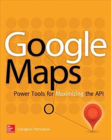
Google Maps: Power Tools for Maximizing the API explains techniques for visualizing masses of data and animating multiple items on the map. You’ll also find out how to embed Google maps in desktop applications to combine the richness of the Windows interface with the unique features of the API. You can use the numerous samples included throughout this hands-on guide as your starting point for building customized applications.
- Create map-enabled web pages with a custom look
- Learn the JavaScript skills required to exploit the Google Maps API
- Create highly interactive interfaces for mapping applications
- Embed maps in desktop applications written in .NET
- Annotate maps with labels, markers, and shapes
- Understand geodesic paths and shapes and perform geodesic calculations
- Store geographical data in KML format
- Add GIS features to mapping applications
- Store large sets of geography data in databases and perform advanced spatial queries
- Use web services to request spatial data from within your script on demand
- Automate the generation of standalone web pages with annotated maps
- Use the Geocoding and Directions APIs
- Visualize large data sets using symbols and heatmaps
- Animate items on a map
Bonus online content includes:
- A tutorial on The SQL Spatial application
- A bonus chapter on animating multiple airplanes
- Three appendices: debugging scripts in the browser; scalable vector graphics; and applying custom styles
Publisher's Note: Products purchased from Third Party sellers are not guaranteed by the publisher for quality, authenticity, or access to any online entitlements included with the product.
Create custom applications with the Google Maps API
Featuring step-by-step examples, this practical resource gets you started programming the Google Maps API with JavaScript in no time. Learn how to embed maps on web pages, annotate the embedded maps with your data, generate KML files to store and reuse your map data, and enable client applications to request spatial data through web services.
Google Maps: Power Tools for Maximizing the API explains techniques for visualizing masses of data and animating multiple items on the map. You’ll also find out how to embed Google maps in desktop applications to combine the richness of the Windows interface with the unique features of the API. You can use the numerous samples included throughout this hands-on guide as your starting point for building customized applications.
- Create map-enabled web pages with a custom look
- Learn the JavaScript skills required to exploit the Google Maps API
- Create highly interactive interfaces for mapping applications
- Embed maps in desktop applications written in .NET
- Annotate maps with labels, markers, and shapes
- Understand geodesic paths and shapes and perform geodesic calculations
- Store geographical data in KML format
- Add GIS features to mapping applications
- Store large sets of geography data in databases and perform advanced spatial queries
- Use web services to request spatial data from within your script on demand
- Automate the generation of standalone web pages with annotated maps
- Use the Geocoding and Directions APIs
- Visualize large data sets using symbols and heatmaps
- Animate items on a map
Bonus online content includes:
- A tutorial on The SQL Spatial application
- A bonus chapter on animating multiple airplanes
- Three appendices: debugging scripts in the browser; scalable vector graphics; and applying custom styles
Tartalomjegyzék:
1. Cartography 101: Fitting a Round Planet on a Flat Monitor
2. HTML Mapping: Embedding Maps in Web Pages
3. JavaScript for Google Maps: A Quick Intro to JavaScript
4. Advanced JavaScript: Events and Objects
5. Programming the Google Maps API: The Basic Objects
6. Windows Mapping: Embedding Maps in Windows Applications
7. Markers and Icons: Identifying Locations on the Map
8. Feature Annotation: Drawing Shapes on Maps
9. Interactive Drawing
10. Geodesic Calculations: The Geometry Library
11. The KML Data Format: Persisting Spatial Data
12. GIS on Google Maps: Building a GIS Application
13. The Backend Database: Storing and Querying Spatial Data
14. Marker Clustering: Handling Many Markers on the Map
15. Sharing Maps: Map Generation and Annotation
16. Making Ajax Calls: Updating maps in real time
17. More Google Services: Directions and Geocoding APIs
18. My Place on Earth: Location Aware Applications
19. Heatmaps: Visualizing Spatial Data
20. Mapping with Style: Customize Maps with Styles
21. JavaScript Animation: Animating Items on the Map
22. Advanced Animation: Animated Drawings
APPENDIX I: Script Debugging
APPENDIX II: Scalable Vector Graphics

