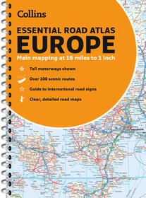
Collins Essential Road Atlas Europe
A4 Paperback
-
8% KEDVEZMÉNY?
- A kedvezmény csak az 'Értesítés a kedvenc témákról' hírlevelünk címzettjeinek rendeléseire érvényes.
- Kiadói listaár GBP 14.99
-
7 161 Ft (6 820 Ft + 5% áfa)
Az ár azért becsült, mert a rendelés pillanatában nem lehet pontosan tudni, hogy a beérkezéskor milyen lesz a forint árfolyama az adott termék eredeti devizájához képest. Ha a forint romlana, kissé többet, ha javulna, kissé kevesebbet kell majd fizetnie.
- Kedvezmény(ek) 8% (cc. 573 Ft off)
- Kedvezményes ár 6 588 Ft (6 274 Ft + 5% áfa)
Iratkozzon fel most és részesüljön kedvezőbb árainkból!
Feliratkozom
7 161 Ft

Beszerezhetőség
Becsült beszerzési idő: A Prosperónál jelenleg nincsen raktáron, de a kiadónál igen. Beszerzés kb. 3-5 hét..
A Prosperónál jelenleg nincsen raktáron.
Why don't you give exact delivery time?
A beszerzés időigényét az eddigi tapasztalatokra alapozva adjuk meg. Azért becsült, mert a terméket külföldről hozzuk be, így a kiadó kiszolgálásának pillanatnyi gyorsaságától is függ. A megadottnál gyorsabb és lassabb szállítás is elképzelhető, de mindent megteszünk, hogy Ön a lehető leghamarabb jusson hozzá a termékhez.
A termék adatai:
- Kiadás sorszáma New Edition, Ne, New edition
- Kiadó Collins
- Megjelenés dátuma 2022. május 15.
- ISBN 9780008403966
- Kötéstípus Puhakötés
- Terjedelem336 oldal
- Méret 294x208x15 mm
- Súly 681 g
- Nyelv angol 254
Kategóriák
Rövid leírás:
Discover new places with handy road atlases from Collins.
Up-to-date A4 paperback road atlas of Europe. Contains clear, large-scale, detailed road mapping, perfect for touring the Mediterranean, Iberian peninsula, Scandinavia and all European tourist destinations.
Hosszú leírás:
Discover new places with handy road atlases from Collins.
Up-to-date A4 paperback road atlas of Europe. Contains clear, large-scale, detailed road mapping, perfect for touring the Mediterranean, Iberian peninsula, Scandinavia and all European tourist destinations.
Scale of main maps 1:1,000,000 (1 cm to 10 km / 1 inch to 16 miles).
Main features
Clear, easy to follow road maps at a scale of 1:1,000,000. Euroroutes and motorways are easily distinguished on the mapping. The maps also show international road classifications, road distances in kilometres and relief is shown by attractive layer tints.
- Route planning maps
- Over 100 scenic routes shown
- Toll motorways shown
- Guide to international road signs, driving advice and useful internet links
- Route maps of 64 major cities
- Street plans of 16 major cities
- Locator diagrams on each page to help you navigate
- More detailed road maps extending from Amsterdam to Munich, making route following easier through this densely populated area
Area of coverage
The mapping extends from the North Cape (Norway) to Gibraltar and from Ireland to east of Moscow. Also includes Iceland and Cyprus.
"The use of light colours in the maps and a 3.2mpi scale make the Collins Essential easy to read at a glance" Auto Express
Több


