

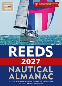
Reeds Nautical Almanac 2027
Series: Reed's Almanac;
-
GET 18% OFF
- Publisher's listprice GBP 54.99
-
24 827 Ft (23 645 Ft + 5% VAT)
The price is estimated because at the time of ordering we do not know what conversion rates will apply to HUF / product currency when the book arrives. In case HUF is weaker, the price increases slightly, in case HUF is stronger, the price goes lower slightly.
- Discount 18% (cc. 4 469 Ft off)
- Discounted price 20 358 Ft (19 389 Ft + 5% VAT)
- Discount is valid until: 31 October 2026
20 358 Ft

Availability
Not yet published.
Why don't you give exact delivery time?
Delivery time is estimated on our previous experiences. We give estimations only, because we order from outside Hungary, and the delivery time mainly depends on how quickly the publisher supplies the book. Faster or slower deliveries both happen, but we do our best to supply as quickly as possible.
Product details:
- Publisher Bloomsbury Publishing (UK)
- Date of Publication 13 August 2026
- ISBN 9781399430975
- Binding Paperback
- No. of pages1104 pages
- Size 265x192 mm
- Language
- Illustrations Full colour harbour charts and diagrams throughout 700
Categories
Short description:
The indispensable annual compendium of navigational data for anyone going to sea around the whole of the UK and the North Atlantic coast from Denmark to Gibraltar.
MoreLong description:
The indispensable trusted annual compendium of navigational data for yachtsmen and motorboaters.
Known as the Yachtsman's Bible, Reeds provides all the information required to navigate Atlantic coastal waters around the whole of the UK, Ireland, Channel Islands and the entire European coastline from the tip of Denmark right down to Gibraltar, Northern Morocco, the Azores and Madeira.
The 2027 Almanac continues the tradition of year-on-year improvement and meticulous presentation of all the data required for safe navigation. Now with an improved layout for easier reference and with over 45,000 annual changes, it is regarded as the essential almanac for anyone going to sea, and is recommended by the RYA, RNLI and Coastguard, and used in training courses all around the UK and Europe.
The 2027 edition is updated throughout and includes: 700 harbour chartlets; tide tables and tidal streams; buoyage and lights; 7,500 waypoints; invaluable passage notes; distance tables; radio, weather and safety information; and a first aid section. Also includes a free Reeds Marina Guide.
Also available: free supplements of up-to-date navigation changes from January to June at: www.reedsnauticalalmanac.co.uk
Table of Contents:
The print version includes: 700 chartlets, Harbour facilities, Tide tables and streams, 7,500 waypoints, International codes and flags, Weather, Distance tables, Passage advice, Area planning charts, Rules of the road, Radio information, Communications, Safety, Mayday and distress procedures, and Documentation and Customs.
More
