- Publisher's listprice GBP 5.99
-
3 461 Ft (2 725 Ft + 27% VAT)
The price is estimated because at the time of ordering we do not know what conversion rates will apply to HUF / product currency when the book arrives. In case HUF is weaker, the price increases slightly, in case HUF is stronger, the price goes lower slightly.
- Discount 15% (cc. 519 Ft off)
- Discounted price 2 942 Ft (2 316 Ft + 27% VAT)
Subcribe now and take benefit of a favourable price.
Subscribe
3 461 Ft

Availability
Out of print
Why don't you give exact delivery time?
Delivery time is estimated on our previous experiences. We give estimations only, because we order from outside Hungary, and the delivery time mainly depends on how quickly the publisher supplies the book. Faster or slower deliveries both happen, but we do our best to supply as quickly as possible.
Product details:
- Publisher Philip's
- Date of Publication 3 March 2022
- ISBN 9781849075916
- Binding Map
- No. of pages pages
- Size 308x228x6 mm
- Weight 340 g
- Language English 0
Categories
Long description:
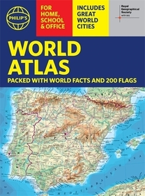
Thousands of global facts at your fingertips with the best value quick-reference World Atlas on the market. Both physical and political geography is clearly illustrated alongside the great cities of our planet.
The highest peak? The deepest ocean trench? The wettest, driest, longest, largest - we list the world's fascinating extremes. Crammed with practical information like a Distance Chart for World Cities, World Time Zones, over 200 State Flags and the top 100 most populous countries, we include around 15,000 places indexed for easy checking. Whether for the pub quiz, travel planning or school reference, this great value handy world atlas is crammed with everything you need to know.
Alongside the topography and physical attributes of the earth we also show political boundaries and the great global cities, including transport hubs and places of interest from mosques to temples, palaces to zoos and shopping centres to tourist information centres.
Features include:
* 200 Flags of the world's major states and territories
* 21 City centre maps: transport (road, rail, trams, light railways, bus and railway stations) and places of interest including religious buildings (churches, abbeys, cathedrals, synagogues, shrines, temples, mosques), museums, galleries, theatres, palaces, castles, parks, gardens, zoos, shopping centres, hospitals, Tourist Centres.
* World city distance table
* World time zones map
* World country comparisons table - the population and areas of the world's top 100 most populous countries
* World physical comparisons- largest oceans, longest rivers, biggest islands, highest peaks, deepest trenches.
* Continental Comparator - for each one we show area, coldest place, hottest place, wettest place, driest place
* World topographic maps - with coloured contour layers and hill-shading clearly outlining the Earth's surface.
* World political maps - the latest boundary and geopolitical changes, with cities, provinces and countries shown.
* Index of around 15,000 place-names - with geographical features like mountains, lakes and deserts, as well as towns.


