

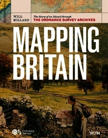
Mapping Britain
The Story of an Island through the Ordnance Survey Archives
-
GET 18% OFF
- Publisher's listprice GBP 30.00
-
13 545 Ft (12 900 Ft + 5% VAT)
The price is estimated because at the time of ordering we do not know what conversion rates will apply to HUF / product currency when the book arrives. In case HUF is weaker, the price increases slightly, in case HUF is stronger, the price goes lower slightly.
- Discount 18% (cc. 2 438 Ft off)
- Discounted price 11 107 Ft (10 578 Ft + 5% VAT)
- Discount is valid until: 31 October 2026
11 107 Ft

Availability
Not yet published.
Why don't you give exact delivery time?
Delivery time is estimated on our previous experiences. We give estimations only, because we order from outside Hungary, and the delivery time mainly depends on how quickly the publisher supplies the book. Faster or slower deliveries both happen, but we do our best to supply as quickly as possible.
Product details:
- Publisher Orion
- Date of Publication 1 October 2026
- ISBN 9781399625845
- Binding Hardback
- No. of pages256 pages
- Size 252x192 mm
- Language English
- Illustrations Full colour maps throughout 700
Categories
Long description:
Ordnance Survey is the home of British mapmaking. Its history dates to 1745, when a twenty-one-year-old engineer was tasked with a small-scale military survey of Scotland.
Mapmakers brings to life this illustrious archive in a beautiful book that tells the story of the changing shape of Britain. These are stories of religion, stories of changing industry, stories of politics and infrastructure, and stories of ourselves - where and why we move around this island, and how we do it. We find disappearing villages, secretive smuggling paths, military plans and the creation of beloved national parks.
The lavish, full-colour volume contains maps from throughout OS's lifetime as well as specially commissioned graphics showcasing the cutting edge in cartographical technology. Written by award-winning writer, broadcaster and expedition leader Will Millard, this is an unmissable record of how our landscape has changed - and how it might do so in the future.

