

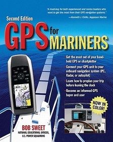
- Publisher's listprice GBP 16.99
-
7 670 Ft (7 305 Ft + 5% VAT)
The price is estimated because at the time of ordering we do not know what conversion rates will apply to HUF / product currency when the book arrives. In case HUF is weaker, the price increases slightly, in case HUF is stronger, the price goes lower slightly.
- Discount 10% (cc. 767 Ft off)
- Discounted price 6 903 Ft (6 575 Ft + 5% VAT)
Subcribe now and take benefit of a favourable price.
Subscribe
7 670 Ft

Availability
Estimated delivery time: In stock at the publisher, but not at Prospero's office. Delivery time approx. 3-5 weeks.
Not in stock at Prospero.
Why don't you give exact delivery time?
Delivery time is estimated on our previous experiences. We give estimations only, because we order from outside Hungary, and the delivery time mainly depends on how quickly the publisher supplies the book. Faster or slower deliveries both happen, but we do our best to supply as quickly as possible.
Product details:
- Edition number 2
- Publisher International Marine
- Date of Publication 16 July 2011
- ISBN 9780071713993
- Binding Paperback
- No. of pages176 pages
- Size 236x185x8 mm
- Weight 348 g
- Language English 0
Categories
Short description:
The operator's manual that should come with every boater's GPS receiver or chart plotter.
MoreLong description:
From the National Education Officer of the U.S. Power Squadrons, here is the operator's manual that should come with every boater's GPS receiver or chart plotter.
About the BookGPS for Mariners was immediately well received by nautical book buyers because it took the mystery out of what was, in 2003, still a somewhat mysterious black box. Sales of the book have been strong ever since--through the U.S. Power Squadrons and the U.S. Coast Guard Auxiliary as well as through bookstores and marine stores.
In the intervening six years, however, GPS has achieved almost universal acceptance. No one needs to be told in detail how the system works or why it is reliable anymore. Boaters today accept GPS as the ultimate navigation tool?they just want to know how to use it.
At the same time, even the most basic GPS receivers are much more full-featured now than six years ago. It's hard to find a new GPS receiver--even a handheld unit--that doesn?t have resident charts or maps, for example. And many boaters now buy chart plotters with integral GPS--and the distinction between a GPS receiver and a full-featured chart plotter has become increasingly blurred. About the only thing that hasn't changed is that the manual that comes with a new GPS receiver or chart plotter is as confusing, fragmented, and incomplete as ever, and in all likelihood never even mentions nautical applications because GPS manufacturers cater to the larger nonboating markets.
In response to these trends, the second edition of GPS for Mariners will have much less GPS tech-talk and theory--no sense preaching to the converted?and more instead on getting the most out of today?s more advanced and powerful units. And the second edition will be presented in full color to do maximum justice to the many screen shots and electronic chart shots the book will feature, thus faithfully replicating the full-color screens of most of today?s GPS receivers and chart plotters.
From the National Education Officer of the U.S. Power Squadrons, here is the operator's manual that should come with every boater's GPS receiver or chart plotter.
About the BookGPS for Mariners was immediately well received by nautical book buyers because it took the mystery out of what was, in 2003, still a somewhat mysterious black box. Sales of the book have been strong ever since--through the U.S. Power Squadrons and the U.S. Coast Guard Auxiliary as well as through bookstores and marine stores.
In the intervening six years, however, GPS has achieved almost universal acceptance. No one needs to be told in detail how the system works or why it is reliable anymore. Boaters today accept GPS as the ultimate navigation tool?they just want to know how to use it.
At the same time, even the most basic GPS receivers are much more full-featured now than six years ago. It's hard to find a new GPS receiver--even a handheld unit--that doesn?t have resident charts or maps, for example. And many boaters now buy chart plotters with integral GPS--and the distinction between a GPS receiver and a full-featured chart plotter has become increasingly blurred. About the only thing that hasn't changed is that the manual that comes with a new GPS receiver or chart plotter is as confusing, fragmented, and incomplete as ever, and in all likelihood never even mentions nautical applications because GPS manufacturers cater to the larger nonboating markets.
In response to these trends, the second edition of GPS for Mariners will have much less GPS tech-talk and theory--no sense preaching to the converted?and more instead on getting the most out of today?s more advanced and powerful units. And the second edition will be presented in full color to do maximum justice to the many screen shots and electronic chart shots the book will feature, thus faithfully replicating the full-color screens of most of today?s GPS receivers and chart plotters.
Table of Contents:
Chapter 1:How GPS Works; Chapter 2: GPS Recievers and Systems: Handhelds, Chartplotters; Chapter 3: Using GPS to Navigate; Chapter 4: Additional GPS Features; Chapter 5: Working with Waypoints and Routes; Chapter 6: Chartplotting;Chapter 7: Navigation Software Systems; Chapter 8: Installing Your GPS; Chapter 9: Working with GPS and Other Onboard Systems; Appendix: Relating GPS Displays to What?s Happening Onboard; Glossary;Resources; Index
More
