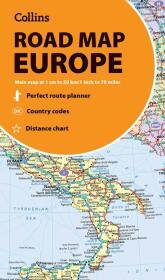
Collins Road Map of Europe
Folded map
- Publisher's listprice EUR 9.90
-
4 966 Ft (3 910 Ft + 27% VAT)
The price is estimated because at the time of ordering we do not know what conversion rates will apply to HUF / product currency when the book arrives. In case HUF is weaker, the price increases slightly, in case HUF is stronger, the price goes lower slightly.
- Discount 5% (cc. 248 Ft off)
- Discounted price 4 717 Ft (3 715 Ft + 27% VAT)
Subcribe now and take benefit of a favourable price.
Subscribe
4 966 Ft

Availability
Estimated delivery time: In stock at the publisher, but not at Prospero's office. Delivery time approx. 3-5 weeks.
Not in stock at Prospero.
Why don't you give exact delivery time?
Delivery time is estimated on our previous experiences. We give estimations only, because we order from outside Hungary, and the delivery time mainly depends on how quickly the publisher supplies the book. Faster or slower deliveries both happen, but we do our best to supply as quickly as possible.
Product details:
- Publisher Collins Learning
- Date of Publication 24 January 2025
- ISBN 9780008716479
- Binding Map
- No. of pages pages
- Size 13x130x230 mm
- Weight 99 g
- Language English 640
Categories
Short description:
Discover new places in Europe with easy-to-read mapping from Collins.
MoreLong description:
Discover new places in Europe with easy-to-read mapping from Collins.
A fully revised and updated colour road map of Europe at a scale of 79 miles to 1 inch / 50km to 1cm (1: 5,000,000). Roads, motorways, European Route numbers, railways, airports, cities and towns are clearly shown, making the map ideal for route-finding and planning journeys.
This map includes:
- Full index to place names (on reverse of sheet)
- Distance chart giving distances in kilometres between main towns
- European Union map showing member states and the Eurozone
- Links to further information on Europe
Area of coverage
Covers the whole of Europe from the North Cape (Norway) to Gibraltar and from Ireland to east of Moscow. Also includes Iceland and Cyprus.
- Key to approved country code abbreviations - GB, F, D etc.
- Map key in English, French, German, Spanish and Italian


