

ATLASES JUNIOR ATLAS
-
GET 18% OFF
- Publisher's listprice GBP 6.99
-
3 155 Ft (3 005 Ft + 5% VAT)
The price is estimated because at the time of ordering we do not know what conversion rates will apply to HUF / product currency when the book arrives. In case HUF is weaker, the price increases slightly, in case HUF is stronger, the price goes lower slightly.
- Discount 18% (cc. 568 Ft off)
- Discounted price 2 587 Ft (2 464 Ft + 5% VAT)
- Discount is valid until: 31 August 2026
2 587 Ft

Availability
Out of print
Why don't you give exact delivery time?
Delivery time is estimated on our previous experiences. We give estimations only, because we order from outside Hungary, and the delivery time mainly depends on how quickly the publisher supplies the book. Faster or slower deliveries both happen, but we do our best to supply as quickly as possible.
Product details:
- Edition number Updated Edition
- Publisher Franklin Watts
- Date of Publication 2 September 2005
- ISBN 9780198321576
- Binding Paperback
- No. of pages72 pages
- Size 292x225x11 mm
- Weight 314 g
- Language English
- Illustrations in full colour (photos and artwork) 0
Categories
Long description:
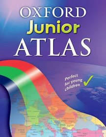
The Oxford Junior Atlas is a clear and informative atlas for all 7-11 year olds. It combines the essential features of simple and colourful mapping with many colour photographs, including aerial photos and satellite imagery. There is good topographic coverage of the United Kingdom at a generous scale, as well as extensive thematic coverage of the British Isles, the Continents, and the World. Illustrated information panels identify issues raised by the map topics that
include Rivers, Weather, Settlement, and Environmental change. Picture icons provide visual clues to common themes. A child-friendly index includes both page numbers and grid references.

