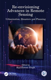
Re-envisioning Advances in Remote Sensing
Urbanization, Disasters and Planning
- Publisher's listprice GBP 45.99
-
21 971 Ft (20 925 Ft + 5% VAT)
The price is estimated because at the time of ordering we do not know what conversion rates will apply to HUF / product currency when the book arrives. In case HUF is weaker, the price increases slightly, in case HUF is stronger, the price goes lower slightly.
- Discount 20% (cc. 4 394 Ft off)
- Discounted price 17 577 Ft (16 740 Ft + 5% VAT)
Subcribe now and take benefit of a favourable price.
Subscribe
21 971 Ft

Availability
Estimated delivery time: In stock at the publisher, but not at Prospero's office. Delivery time approx. 3-5 weeks.
Not in stock at Prospero.
Why don't you give exact delivery time?
Delivery time is estimated on our previous experiences. We give estimations only, because we order from outside Hungary, and the delivery time mainly depends on how quickly the publisher supplies the book. Faster or slower deliveries both happen, but we do our best to supply as quickly as possible.
Product details:
- Edition number 1
- Publisher CRC Press
- Date of Publication 7 October 2024
- ISBN 9781032124605
- Binding Paperback
- No. of pages312 pages
- Size 234x156 mm
- Weight 500 g
- Language English
- Illustrations 126 Illustrations, black & white; 47 Halftones, black & white; 79 Line drawings, black & white; 81 Tables, black & white 602
Categories
Short description:
This book discusses advances in remote sensing pertaining to urbanization, disasters, and planning, through available geospatial data supported by various case studies. It covers urbanization and its impact, geospatial technology for disasters and urban management, and natural disasters, models, and planning applications including GPS devices.
MoreLong description:
Re-envisioning Advances in Remote Sensing: Urbanization, Disasters and Planning aims at portraying varied advancements in remote sensing applications, particularly in the fields of urbanization, disaster management and regional planning perspectives. The book is organized into three sections of overlapping areas of research covering chief remote sensing applications. Apart from introducing the advances in remote sensing through Indian remote sensing developments, it depicts the broader themes of: urbanization and its impacts; geospatial technology for disaster management; and, remote sensing applications in models and planning. It also provides outlook to future research agenda for remote sensing.
Features:
• Depicts advances in remote sensing in major fields through applications of geospatial technologies.
• Covers remote sensing applications in varied aspects of urbanization, urban problems and disasters.
• Includes advancements in remote sensing in model building and planning perspectives.
• Analyses the usage of smartphones and other digital devices in mapping urban problems and monitoring disaster risks.
• Explores future agenda for remote sensing advances and its ever-widening horizon.
This book would be of interest to all the researchers and graduate students pursuing studies in the fields of remote sensing, GIS, geospatial technologies, urbanizations, disaster management, regional planning, environmental sciences, natural resource management and related fields.
MoreTable of Contents:
Introduction: Re-envisioning Advances in Remote Sensing. Section I. Urbanization and its Impact. 1. Remote Sensing Applications in Urbanization and its impact on Environment: A Case Study of Noida City. 2. Dynamics of Urban Land Use and its Impact on Land Surface Temperature (LST) in Aligarh City, Uttar Pradesh. 3. Use of a Smartphone to Map Noise Pollution: A Case Study of Ludhiana City. 4. An Assessment of Urban Green Spaces under the Smart Cities Mission: The Case of Qaiserbagh ABD Area of Lucknow City. 5. Impact on Land Surface Temperature and Urban Heat Island Due to Land Use Land Cover Change in Dhaka Metropolitan Area Using Remote Sensing and GIS Techniques. Section II. Geospatial Technology for Disaster Management. 6. Spatio-Environmental Distribution of Drought Disaster Events: A Space-Based Approach using Terra-MODIS Vegetation Index. 7. Sustainable Management of Waterlogged and Salt Affected Areas through Geo-Spatial Technology –A Case Study of Central Haryana. 8. Flood Risk Assessment and Analysis of Kashmir Valley Floor through Remote Sensing. 9. Remote Sensing Applications in Landslide Susceptibility Index Mapping of Rangamati District, Bangladesh. 10. Remote Sensing Applications in Landslide Assessments: Case of Kotropi in Himachal Himalayas. 11. Geospatial techniques to quantify urban change: A case of Harare, Zimbabwe. Section III. Remote Sensing Applications in Models and Planning. 12. Remote Sensing & GIS based Site Identification for Solid Waste Management for Urban Planning of Amritsar Municipal Corporation, Punjab, India. 13. Use of Remote Sensing Techniques in Land Degradation Mapping. 14. Feasibility Analysis of a Railway Route using Remote Sensing/Geoinformatics and Analytical Hierarchy Process (AHP) Techniques. 15. Comparing Performance of Inverse Distance Weighting and Modified Shepard Interpolation Models with Different Sampling Arrangements: A Case Study. 16. Application of Remote Sensing in the Groundwater Potential Analysis of Developing Countries. 17. Village Identification on the basis of Intensity of Problems in Physical Resources in the Kandi Region of Punjab for Micro Level Planning. Conclusion: Outlook to Future Research Agenda.


